Dambanza Fm
Type Locality and Naming
Joulia, 1951, 1953. The Lower (clay-rich) of the Dambanza Fm is included in the Damergou Gr. The Upper portion (sand-rich) of the Dambanza Fm does not belong to any group.
References: Furon, 1934; Joulia, 1951, 1953; Faure, 1963 & 1966, page 159; Petters, 1981; Fabre et al., 1983.
Synonym: Equivalent(s): Upper part of the Dambanza is equivalent to the Majias Gr. The lower portion of the Dambanza is equivalent to the Ibeceten Fm.
Lithology and Thickness
Clays (Lower portion) and coarse-grained sandstones (Upper portion). Many ferruginous levels in platelets in the upper portion of the Dambanza. This level is defined by a coarse sandstone with cross-bedded stratification containing kaolinitic clays, pisolitic and oolitic ironstones, and bauxite defines this level. Its thickness is 50 m for the upper part and 33 m for the lower part.
Relationships and Distribution
Lower contact
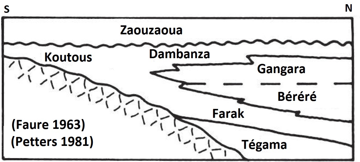
Underlying unit is the Gangara Fm (Refer to Fig. 1)
[Figure 1: Schematic stratigraphic section from Southeast Aïr to the south of Koutous area (Source: Faure, 1963; Petters, 1981)]
Upper contact
Overlying unit is the Zaouzaoua Fm (Fig. 1)
Regional extent
GeoJSON
Fossils
Age
Depositional setting
Continental for the upper part and a mixed continental and marine environment for the lower part.
Additional Information
